The view of the Shenandoah Valley from Bird Knob, taken during the 2001 Catherine’s Fat Ass.
Keith Knipling
Catherine’s Fat Ass
Roughly 50 km run in the southern Massanuttens named for nearby Catherine Furnace, one of four iron blast furnaces operated within that mountain range during the 19th century.
- Date
-
- Sat Jul 20, 2024
- Start location
- Start time
-
- 7:00 am
- Distance
-
- 29.1 miles
- Total ascent/descent
-
- 5,700 feet
- Aid stations
-
- Bird Knob (5.9 miles)
- Catherine's Furnace (10.3 miles)
- Morgan Run (13.0 miles)
- Pitt Spring (18.4 miles)
- Catherine's Furnace (20.2 miles)
- Bird Knob (24.5 miles)
Entry into the 2024 edition of Catherine’s Fat Ass 50k will open on June 20th at 9 AM, exactly one month before the run, and we will open the field to 75. If needed, a wait list will be created, in order of entry after those first 75 are accepted in. The wait list will be utilized in chronological order; last year, everyone on the waitlist ultimately was afforded the opportunity to join the entrants list. So if you get on that list, be patient, know that the final word will likely arrive mid-week before the run, and that you are highly likely to get in!
If you have signed up for the run, either as a direct entrant or as a member of the wait list, please email RD Chelsea Smith if you find that you will not be able to come out for the run after all. This courtesy to your fellow runners and to the RDs is very much appreciated!
In 2014, and after 14 wonderful years as Catherine’s FA’s director, event co-founder Jeff Reed decided to pass on the torch. At that time Dan Aghdam took over as the VHTRC’s director for this very difficult, hot, and awesome event. In 2022, the transition to yet another era began, with Chelsea Smith directing the event that year with Dan. In 2023 Chelsea took over as the solo CFA RD, as Dan took the helm at the Massanutten Mountain Trails 100 Miler that year.
- Your CFA 50k course will have 6 Aid Stations. Aid stations 1, 2, 5, and 6 will be fully stocked. Aid stations 3 and 4 will have water only. [Note: AS 1 and 6 are at the same location - Bird Knob; AS 2 and 5 are also at the same location - at the Catherine’s Furnace.]
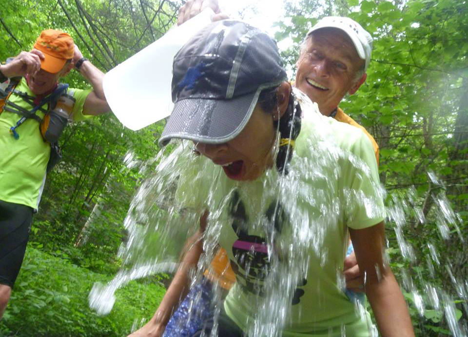
- The fully stocked aid stations will consist of liquids supplied by the club (water, Gatorade, sodas and ice), and aid bags provided by each runner. So be sure to bring two labeled Ziploc bags for those two aid points with your personal food and/or drink options to the start, and drop them in the appropriate bins when you check-in pre-run. You will then find one bag during your two passes through the Catherine’s Furnace aid station (A.S 2 and 5), and your other Ziploc bag during your two passes through the Bird Knob aid station (A.S. 1 and 6). The aid station volunteers will endeavor to bring those runner bags back to the finish after they close, but don’t expect to get them back until mid-afternoon at the earliest, and don’t put anything you would hate to lose in either bag. These are not drop bags, they are for your aid purposes only - so no change of clothing, shoes, etc.
- All runners who enter the event will have to stay on the course. If you choose to take a different path you are required to drop out of the event at an AS and you must let the AS Captain know that you are dropping out. From that point on you are on your own.
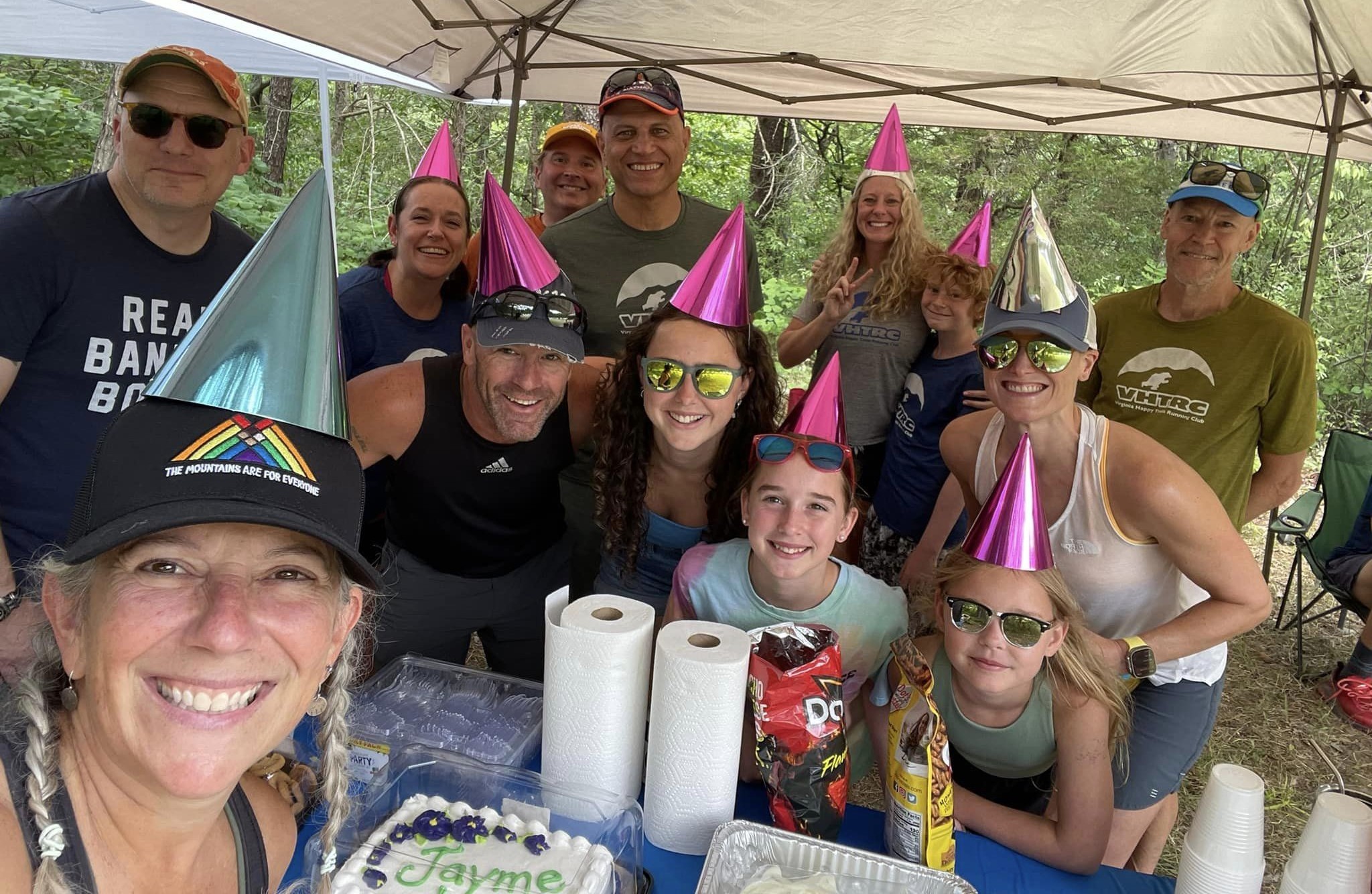
- As usual, we will have a great party at the end. So plan your day to allow plenty of time for post-run recovery and socializing!
Volunteers are the life blood of the CFA 50k! If you are interested in coming out the day of the event to help, please contact RD Chelsea Smith. We are also looking for course markers the day before the run; again, contact RD Chelsea to help out on the trails!
Course description
Start to Bird Knob — about 6 miles
From the parking lot the early miles climb gradually up a twisty and sometimes rocky trail for about 1.9 miles to the start of the steep climb up to Bird Knob. It is about 1.5 mile to a picnic area, and then another .4 mile to the start of the climb up to Bird Knob. The trail forms a T intersection, and the Bird Knob trail is on the left (if you continued straight, you would go to the Visitors Center). So you must turn left on the orange blazed trail and go up the mountain. You go up for about two miles — steep for only a half mile or so, then slightly less intense. Be sure to check out the views at the top. You can look over New Market and the green Shenandoah Valley below. Really excellent!
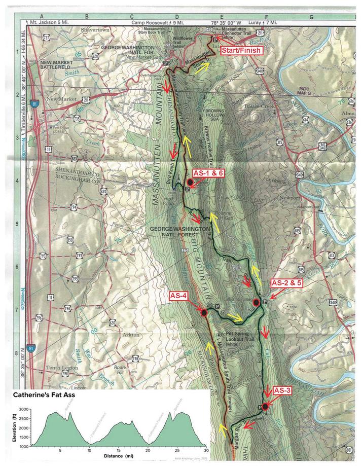
The trail continues on south along the top, with some slight ups and downs, with lots of flat rocks, but it gets a little more runnable as you continue south. You will come to a sign on the right side of the trail that says something like Bird Knob is a couple of miles ahead, but indicates there is a trail to the left. Continue on (to the right) toward Bird Knob, and following the white blazes. You will run some more miles, and crossing some cleared Forest Service roads (but continue on the trail south). You will eventually come to a clearing. The trail will seem to die, with a faint hint of trail to the left and ahead — turn left and go down the hill. As you go, you will see the trail pick up again and go down into a little gully. It broadens and becomes easy to run. You will go to a Forest Service road again, and find yourself running on it through the little gully, then up to the southeast to a gravel road. There will be a metal barrier across the road. Go around it onto the gravel road. You have just completed the first section — estimated to be about 6 miles. This is also the location of the first aid station of the run.
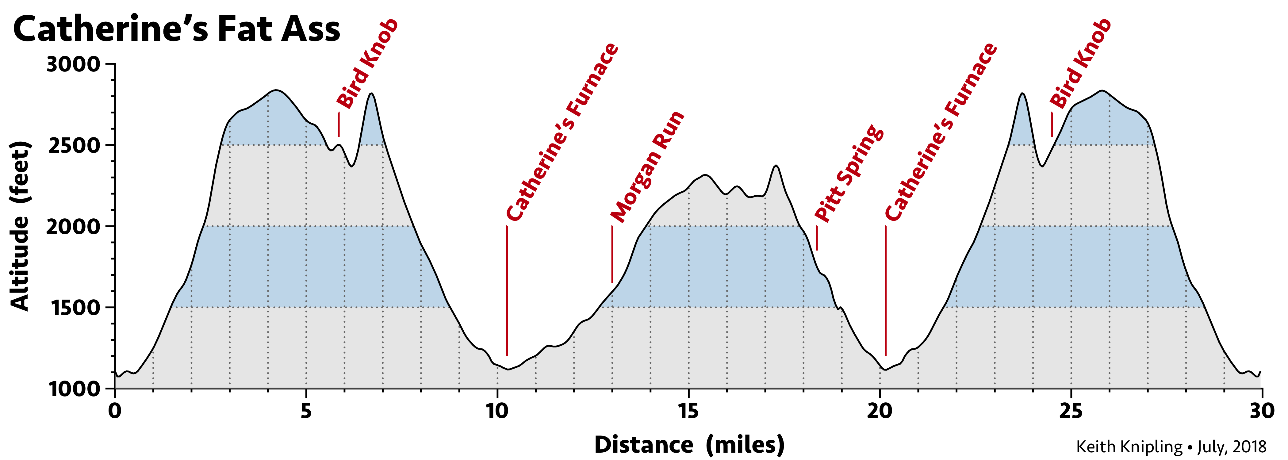
Bird Knob to Catherine Furnace — about 4 miles
After you leave the aid station follow the dirt road down for about ½ mile and you will come to a left turn on Roaring Run Trail (Purple). Make the left turn and go up to the top and turn right to go down the Purple Trail, heading south (do not turn on Pink), in between two mountains until you reach a gravel road. Turn right, cross a bridge and then behold, you are at Catherine Furnace. The aid station is in the grassy area directly in front of the furnace and next to the stream you have just crossed.
Catherine Furnace to the Yellow Trail — about 3 miles
After refilling at Catherine Furnace, continue on the road for about a quarter of a mile. Bear left at the road junction, and across the little bridge onto Cub Run Road. Up you go for about 2 and a half miles to the Morgan Run Trail (Yellow). Aid station number 3 is located at the turn onto Yellow (water only). This station is more limited in its offerings than the major aid stations.
Yellow Trail to the Orange Trail — about 1.5 miles
The Yellow Trail (Morgan Run Trail) goes up to the Orange Trail, heading west. It is nearly straight up a hollow in between opposing mountain slopes. It just about goes up the middle of a stream too — called Morgan Run. It is truly beautiful and green, but rocky and slow going. Be VERY careful on what can be slippery rocks. Think of this section as icy and you will stay upright. As you get to the top the trail will flatten out and get soft. There are a lot of ferns, and it could be a bit muddy. At the junction with the Orange Trail turn right.
Orange Trail to Pitt Spring — about 3.7 miles
The Orange Trail heads north, with some ups and downs, but it is generally a very runnable Forest Service fire road. You will run along it for about 3.7 miles. As you approach Pitt Spring, there will be a clear change to a steep downhill trail. You will come out to the spring, and a water only aid stop.
Pitt Spring to Catherine Furnace/Purple Trail — about 2 miles
After the Pitt Spring aid you will go to the right on the gravel road heading down (east) back to Cub Run. Except this time, when you reach the marked intersection, turn left and follow the dirt road back to Catherine Furnace (aid station #5). The furnace will be on your left, clearly visible.
Purple Trail End to Bird Knob — about 4 miles
After the Furnace aid station, you again cross the bridge and then immediately go left to get back on the Roaring Run Trail, more infamously known by the color of its blazes: the Purple Trail. The Purple Trail was all fun in games when you came down it early in the morning. At this stage of the run, it is evil. It is long, slow climbing, in a hot part of the day, on a difficult, rocky trail. The start is kind of cool — shaded and easy to run, but it gets insidious within a mile. And that’s the bite. You think it is going to be easy, but it just keeps on going up. Oh hell, it is still fun, of course, but be prepared for your legs to be aching when you get over the mountain to the road. You will go up the Purple Trail, heading north, in between two mountains. This is a long, progressively steeper climb. You are not anywhere close to the top until you get to the switchbacks (five in total). Follow the too steep downhill to the dirt road and make a right turn. There is a nice view of the valley if you stop there and look back from where you came.
After only half a mile of dirt road you will come to aid station number six. From the aid station, you continue up the dirt road straight to a metal gate. Go around the barrier and follow the “Ant Road.” This section should also be blazed orange. From this gate all the tough uphills are done! It is not quite all downhill from here, but close enough!
Back to the Start — about 6 miles
The gravel road will change into a wide dirt road, then grow narrower, but still clearly a jeep type road. The orange-blazed dirt road feels longer than it looks on the map. At the end is a clearing, and the Bird Knob Trail in on the left of the clearing. There will be a little opening, and pretty much nowhere else to go. Within a few dozen feet, you will come upon the sign you saw in the first section. Turn right, head to the north, and go back down the mountain. It will still be some miles before you are done, but the trail will be somewhat familiar, shaded, and with some great views on the way. At this point you are retracing your steps in the first few miles of the run to get back to the start. At the bottom of the Bird Knob Trail, turn right and continue back to the Route 211 Commuter Parking Lot. It is a nice, fun and gentle downhill for most of those final 2 miles, and you will be very happy indeed by that time to be done.
About
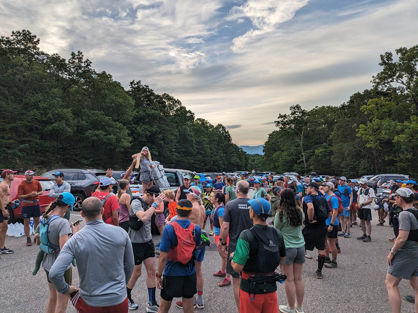
Catherine’s FA 50k has been going on, more or less, since 2001. It was originally founded by Peyton Robinson and Jeff Reed (see Jeff Reed’s old CFA site). Over the years it has become one of the most popular events for local VHTRC runners, and sometimes for not so local ultrarunners. This is mostly due to the course, which is beautiful and difficult; to the friendly atmosphere; and to the awesome trail party that always forms in the Route 211 Commuter Parking Lot at the start/finish. No matter the weather, the vibe at the finish is cool, the food is great and the beverages refreshing. Plan to spend some quality time after your finish enjoying the camaraderie of the VHTRC and your fellow runners at the famous “party-in-the-parking-lot!” It is particularly great to see how many runners are still there for those last few finishers (and the RD doesn’t mind those extra hands when it comes time to pack up at the end, as well!)
The course itself totals just under 50k, but nobody has ever complained about it being too short. Much of the course is very runnable, only to have all that running kick you in the butt later. You get to navigate over rocky climbs, smooth wooded trails, mossy creek beds, great overlooks, and well-maintained dirt roads, while potentially encountering goats, bears, snakes, deer, Kniplings, and other wildlife. What more could you ask?
It should also be noted that over the years many individuals have contributed towards making this event a possibility. In addition to Jeff Reed and Dan Aghdam, I would like to especially thank Peyton Robinson, Tom Corris, Bill “Van Animal” Van Antwerp, Linda Wack, Vicki Kendall, Dave Yeakel, Quatro Hubbard, Mike Bur, and Brian McNeil among many, many others, without whom this event would not have happened or lasted over the years. Thank you.
Last updated January 2, 2024
Club Event Participant Medical Policy
This is an event with very real risks to your well being. The VHTRC does not provide medical care for runners at this event. Runners are responsible for their own health, safety, and well being at this event. No doctors, nurses, or emergency medical technicians, or anyone with any medical training are available along the course, at any aid station, or at the finish. The club does not supply any medical goods or services, including bandages, splints, antiseptic, or Ibuprofen or any other drugs to maintain the health of runners. Physical, medical, and emergency care is the runners' responsibility. In case of an emergency, we will endeavor to get local emergency personnel to an injured runner as soon as possible. Since most of our events are in remote areas, medical care may be far away in distance or time. Each year, runners finish — or are forced to drop out — with scrapes, deep cuts, hematomas, dislocations, and sprains. Runners have experienced cuts, bruises, bee stings, and asthma attacks. This is an event with very real risks.